Информатика и вычислительная техника
  • формат pdf
  • размер 9.44 МБ
  • добавлен 22 ноября 2009 г.
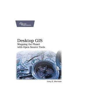
Desktop GIS: Mapping the Planet with Open Source Tools
Publisher: Pragmatic Bookshelf Publication: 2008, English ISBN: 9781934356067 Pages: 368

Desktop GIS explores the world of Open Source GIS software and provides a guide to navigate the many options available. Discover what kind of GIS user you are and lay the foundation to evaluate the options and decide what software is best for you.
Desktop GIS examines the challenges associated with assembling and using an OSGIS toolkit. You'll find strategies for choosing a platform, selecting the right tools, integration, managing change, and getting support. The survey of OSGIS desktop applications provides you with a quick introduction to the many packages available. You'll see examples of both GUI (Graphical User Interface) and command line interfaces to give you a feel for what is available.

This book will give you an understanding of the Open Source GIS landscape, along with a detailed look at the major desktop applications, including GRASS, Quantum GIS, uDig, spatial databases, GMT, and other command line tools. Finally, the book exposes you to scripting in the OSGIS world, using Python, shell, and other languages to visualize, digitize, and analyze your data.

About the Author
Coming from a natural sciences background, Gary Sherman has been torturing computers and programming languages for years. Gary has been using and customizing Geographic Information Systems for well over 16 years. In 2002 he founded the Quantum GIS project, an Open Source desktop GIS application for viewing and editing data. Gary lives and works in Alaska and commutes virutally around the world via the Inteet.
Похожие разделы
  1. Академическая и специальная литература
  2. Геологические науки и горное дело
  3. Горно-геологическая периодика
  4. ArcReview
  1. Академическая и специальная литература
  2. Геологические науки и горное дело
  3. Информационные технологии в горно-геологической отрасли
  4. Геоинформационные системы в геологии
  1. Академическая и специальная литература
  2. Геологические науки и горное дело
  3. Матметоды и моделирование в горно-геологической отрасли
  1. Академическая и специальная литература
  2. Геологические науки и горное дело
  3. Матметоды и моделирование в горно-геологической отрасли
  4. Геостатистика
  1. Академическая и специальная литература
  2. Лесное дело и деревообработка
  3. Информационные технологии в лесном деле
  4. Геоинформационные системы в лесном деле
  1. Академическая и специальная литература
  2. Математика
  3. Теория вероятностей и математическая статистика
  4. Математическая статистика
  5. Прикладная математическая статистика
  6. Пространственная статистика
  1. Академическая и специальная литература
  2. Науки о Земле
  1. Академическая и специальная литература
  2. Науки о Земле
  3. Дистанционное зондирование Земли
  1. Академическая и специальная литература
  2. Науки о Земле
  3. Картография
  1. Академическая и специальная литература
  2. Науки о Земле
  3. Периодика наук о Земле
  4. ИнтерКарто/ИнтерГИС
  1. Академическая и специальная литература
  2. Экологические дисциплины
  3. Информационные технологии в экологии
  4. Геоинформационные системы в экологии
  1. Прикладная литература
  2. Компьютерная литература
  3. ArcGIS
  1. Прикладная литература
  2. Компьютерная литература
  3. MapInfo
  1. Прикладная литература
  2. Компьютерная литература
  3. Micromine
  1. Прикладная литература
  2. Компьютерная литература
  3. QGIS
  1. Прикладная литература
  2. Компьютерная литература
  3. Компьютерная периодика
  4. Reporter
  1. Прикладная литература
  2. Компьютерная литература
  3. Компьютерная периодика
  4. Геоматика
Смотрите также

Греков Л.Д. Красовський Г.Я. Космічний моніторинг забруднення земель техногенним пилом

  • формат pdf
  • размер 45.2 МБ
  • добавлен 11 января 2012 г.
Монографія К.: Наук, думка. 2007. — 123 с. УДК 528.8+632.15+332.37:334.012.12 ISBN 978-966-00-0621-7 Розроблено технологію синтезу картографічних моделей забруднення земель техногенним пилом зосереджених і просторово-розподілених джерел викидів в атмосферу, реалізація якої припускає наявність таких інформаційних ресурсів: космічні знімки середньої і високої просторової роздільної здатності (супутники SPOT, LANDSAT, МЕТЕОР-ЗМ та ін.); параметр...

Программа - Geopainting GPSMapEdit 1.1.73.2 Multilanguage

software
  • формат exe
  • размер 2.35 МБ
  • добавлен 06 февраля 2012 г.
Geopainting GPSMapEdit - this software is designed for visual authoring of GPS-maps in various proprietary cartographic formats such as Garmin, Polish format, ALAN Map 500/600, Holux, Navitel Navigator. GPSMapEdit is designed to help owners of Garmin, ALAN, Holux and Navitel Navigator. GPS receivers to create own maps. The software allows to quick loading and viewing vector maps in so-called "Polish format", comparing them with different geodetic...

Цветков В.Я. Геоинформационные системы и технологии

  • формат doc
  • размер 3.16 МБ
  • добавлен 26 сентября 2009 г.
М.: «Финансы и статистика», 1997. - 290 с. Содержание: К читателю Введение Системный анализ ГИС Общие сведения о системном построении информационной системы Построение схемы обобщенной ГИС Место ГИС среди других автоматизированных систем Основные принципы функционирования АСНИ Системы автоматизированного проектирования Автоматизированные справочно-информационные системы Применение экспертных систем в ГИС Характеристика ЭС Типы...

Church R.L., Murray A.T. Business site selection, location analysis and GIS

  • формат pdf
  • размер 8.03 МБ
  • добавлен 27 декабря 2011 г.
John Wiley & Sons, Inc., 2009. – 314 pages. Location theory is rooted in the disciplines of geography, engineering, mathematics, and economics. The science of ‘‘where should it be’’ is truly multidisciplinary and continues to be of interest to practitioners and researchers alike representing a variety of ?elds, ranging from business to operations research to computer science. We consider Geographic information systems (GIS) and optimization t...

John T. Sample, Elias Ioup. Tile-Based Geospatial Information Systems

  • формат pdf
  • размер 5.23 МБ
  • добавлен 06 марта 2011 г.
Springer, 2010 Background of Web-Based Mapping Applications Logical Tile Schemes Tiled Mapping Clients Image Processing and Manipulation Image Tile Creation Optimization of Tile Creation Tile Storage Tile Serving Map Projections Tile Creation using Vector Data Case Study: Tiles from Blue Marble Imagery Case Study: Supporting Multiple Tile Clients KML Server WMS Server

Schneider M. Spatial Data Types for Database Systems. Finite Resolution Geometry for Geographic Information Systems

  • формат pdf
  • размер 5.46 МБ
  • добавлен 29 октября 2011 г.
Издательство Springer, 1997, -282 pp. Database research in the last decade has focused on developing support for so-called non-standard applications. One important area is the representation of spatial information, needed, for example, in Geographic Information Systems. Database systems extended by capabilities for managing spatial information are called spatial database systems. This book contributes to the design and implementation of geometry...

Shekar S., Xiong H. (eds.) Encyclopedia of GIS

Энциклопедия
  • формат pdf
  • размер 30.78 МБ
  • добавлен 19 октября 2011 г.
Издательство Springer, 2008, -1391 pp. The publication of a definitive Encyclopedia of GIS that lays out many of the computer science/mathematics foundations of the field is a major event, the culmination of a half century of development. I was part of the earliest stirrings in the mid-1950s. A small group of geography graduate students at the University of Washington, William Garrison’s space cadets, began to assemble what became the foundation...