United Kingdom Hydrographic Office. 5th edition. 2004. Revised &
updated, includes official 2004 update supplement. The great
classic of the wind sailors, world. Includes 138pp. on sailing ship
routes. The World Climatic Chart incl.winds, Jan; The World
Climatic Chart incl.Winds; July; Steamship Routes-Atlantic;
Steamship Routes – Indian Ocean; Steamship Routes – Pacific; The
World Selling Ship Routes; The World-Surface Currents; The World
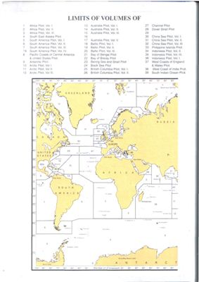
Index chart. Index chart in b&w photocopy (From an Abebooks
listing)
NP 136 - Admiralty Ocean Passages for the World
- формат pdf
- размер 27.88 МБ
Смотрите также
Admiralty Manual Of Navigation Vol. 1
- формат pdf
- размер 27.99 МБ
- добавлен 19 мая 2011 г.
The English Book Store. 1964. 501c. Position and direction of the Earth's Surface. Admiralty charts and publications. The Ship's position and track. Fixing by Observation of Terrestrial Objects. Navigation in Pilotage Waters. Radio aids to Navigation. Navigational instruments. Tides and Tidal streams. Navigation in ice. Graphical problems. Rules of the road.
NGIA-Hand Book of Magnetic Compass Adjustment
Стандарт- формат pdf
- размер 1.93 МБ
- добавлен 15 мая 2011 г.
2004. 46 с. This document has been prepared in order to present all pertinent information regarding the practical procedures of magnetic compass adjustment in one text. As such, it treats of the basic principles of compass deviations and their correction, and not of the details of particular compass equipment. Although this text is presented as a systematic treatise on compass adjustment, ship's personnel who are inexperienced with compass correc...
Ocean Prediction Center's Radiofacsimile Charts User's Guide
- формат pdf
- размер 1.25 МБ
- добавлен 13 мая 2011 г.
November 03, 2005. Introduction to Ocean Prediction Center's (OPC) Radiofacsimile Program.
Ochi M. Hurricane Generated Seas
- формат pdf
- размер 5.9 МБ
- добавлен 17 октября 2011 г.
Elsevier Science, 2003, 140 Pages Hurricanes are one of the most adverse aspects of the ocean environment, with the potential to cause a disastrous event for marine systems in the ocean. This is an invaluable reference for all involved in the field of naval, ocean and coastal engineering. The work clarifies hurricane generated sea conditions necessary for the design and operation of marine systems in a seaway, and provides information for the p...
Symbols and Abbreviations used on Admiralty Charts
- формат pdf
- размер 2.25 МБ
- добавлен 18 мая 2011 г.
Chart 5011 Edition 4 - October 2008 Published at Taunton, United Kingdom under the Superintendence of Rear Admiral J. A. L. Myres, Frics, Hydrographer of the Navy, 1991.Chart 5011 is primarily a key to symbols and abbreviations used on Admiralty and International paper charts compiled by the UKHO (United Kingdom Hydrographic Office). Variations may occur on charts adopted into the Admiralty Series that were originally produced by another hydrogra...